History of Mapping Hong Kong Part 6 – 1901 The Tate Map
Tymon Mellor: Tucked away behind rows of red and white Victorian houses, at the end of the crosshatched street of Exhibition Road, lies The Royal Geographical Society. Whilst Lowther Lodge has been the home of the RGS since 1912, visitors are ushered into their new extension, the Foyle Reading Room. Galvanised steel frames and large glass walls strike a modern contrast to the immediate surroundings and still, a profound connection to Britain’s colonial history exists beneath the surface. Descending an open spiral staircase you arrive at the study; a space filled with chest of draws, laying out tables and bathed in natural light. It is a window onto the world. Waiting on a trolley is file RGS536002 “China, traced from portion of map of New Territory Kowloon. Compiled by Mr. G. P. Tate for Colonial Government Survey 1899-190[1]. Tate, G. P. (George Passman), 1856-1941 [Compiler]”. It is the first colonial map of the New Territories and which has been lost since 1904.
Need A New Map
At the time of the acquisition of the New Territories, the only map available of the area was the Map of the San On District produced by an Italian missionary, or as recorded by Mr Lockhart “In order to facilitate consideration of this territory, a map of it has been specially prepared by Mr. Ormsby, Director of Public Works, Hongkong based on the excellent map made by Bishop Volontieri in 1866”[1]. A new map was needed.
The location of the new frontier with China was agreed in March 1899 and now the priority was to establish “the land under cultivation should be surveyed as quickly as possible”[2]. This was required to define land holdings, land registration and to support the collection of land taxes.
With no suitably experienced surveyors in the territory, the Governor Henry A Blake reached out to the Surveyor General of Ceylon, Mr Grinlinton for advice, who recommended a complete survey of the colony. With the support of Mr Ormsby, and Colonel Elsdale, commander of the Royal Engineers, an application was made to the colonial Indian Government to lend the necessary staff. The Survey of India, had extensive experience in mapping new territory having completed the survey of the continent in 1871, and was now extending its services to surrounding areas.
The Surveyor General of India noted that “As the areas is small and no great difficulties are likely to be experienced”, he proposed two senior staff, one to be in charge of the exercise with a focus on the triangulation and topographic survey, and a second to look after the cadastral survey[3]. The cost of the survey staff was originally estimated to be $17,180[4] for completion by the end of December 1901.
The Leaders
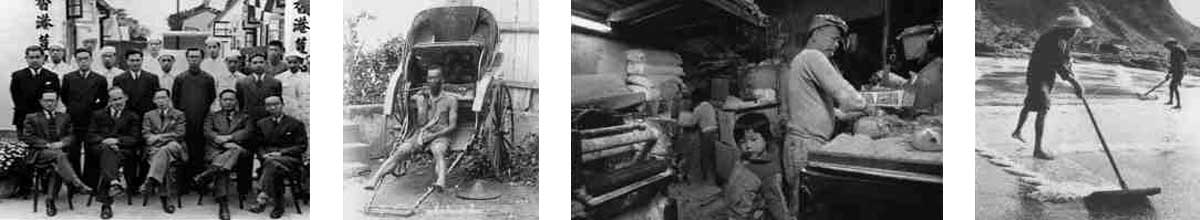
The team was led by George Passman Tate, a Provincial Officer in the Survey of India, who arrived in Hong Kong on the 19th October, 1899. Tate was born in Bengal, India on 22 July 1856 to an influential family. His uncles (mother’s brothers) were Sir George Kellner KCMG and E W Kellner CIR, Military Accountant General in India and Accountant General of the Punjab respectively[5].He joined the Survey of India as an apprentice in March 1874, aged 18 and worked his way up through the organisation. His performance was described as “thoroughly satisfactory, and might even be called brilliant for a man in his position”. At 43 years old with such a reputation and experience of establishing new surveys in Afghanistan and Pershin territories, he was selected to lead the Hong Kong mission.

Tate with his Plane Table In Persia (1902)
Tate was assisted by William John Newland, a 23 year[6] old member of the Survey of Indian team. Newland was born on the 13 September 1876 in much humbler surroundings, as his father was a baker living in the centre of Plymouth, a major English sea port and naval dockyard. Newland and a small contingent of Indian trained surveyors and assistants arrived in Hong Kong on the 1st November 1899 with a second batch of surveyors arriving at the end of November, 1899.
Mr Tate’s team had three objectives:
- to establish a series of survey stations throughout the territory using triangulation to establish their coordinates;
- to prepare a topographical map of the area at a scale of 1 inch to the mile; and
- to prepare cadastral land plans at a scale of 16 inches to the mile.
Prior to the commencement of the survey a notice was issued in Chinese and posted throughout the territory explaining the objectives of the survey:
“The Government has now decided that the land within the New Territory shall be thoroughly surveyed and when the work is properly carried out everyone’s land, whether situated on hills on in valleys, will be marked on a map and the boundaries thereof will be minutely delineated. The areas will then be clearly defined and no one will be able to encroach on or appropriate the land of others. This survey ordered by the Government is intended to aid you in the protection of your own land, to prevent litigation and to enable you to long enjoy the peaceful possession of your property….”
“When the survey officers are working in your neighbourhood, you gentry and people should, with due consideration for the good intentions of His Excellency the Governor, strive to assist the surveyors and in no way obstruct or molest them. Whenever such survey officers have any question to ask, you should answer them truthfully. All marks put up during the survey should in no case be removed. If any one dares to disobey he shall be severely punished without leniency.
Dated this 21st day of November, 1898”
Mr Tate’s approach was to adopt the same strategy that had been successfully used for the Great Trigonometrical Survey of India (1802-1871). However, it soon became apparent that the selected map scales were not suitable for the small terraced hillside fields found in Hong Kong and after much debate the scale of the cadastral survey was increased to 32 inches to the mile or 1:1980.

Photograph Taken By Tate (1900)
Triangulation & Topographic Survey
Newland immediately started work on the cadastral survey while Tate focused on establishing a territory wide triangulation network to provide a framework for the development of the topographic survey. Details of the work undertaken by Newland will be addressed in a separate article.
The process of triangulation utilises trigonometry to establish the location of points, known as trig points or survey stations, using a series of triangles to establish distance and angles allowing coordinates for the station to be calculated. Key to the success of this approach is to start with a known baseline. The two points need to be clearly identifiable, and the distance between the two measured to a high precision to avoid introducing errors into the calculations.
Tate’s initial task was to establish a suitable baseline. He explored Kowloon but was unable to find a long flat area suitable for the task, but at Tin Hau in Causeway Bay, he found a suitable location along the new Shau Ki Wan Road to the east of the bay, now called Electric Road. The northern station was located near the gateway to an oil company’s office and the southern station was located on the north-east corner of a polo ground, some 500m apart[7]. With the assistance of two Chinese constables to control traffic, the distance between the two points was measured four times using a steel tape. The greatest difference measured was 2” or a mean of 1” and giving an error of 1/19,932. This level of accuracy was satisfactory for the survey.

Tate Survey Baseline (Map 1901)
From the baseline, new stations were established on Hong Kong Island using a network of survey stations previously established by the military and extended across the harbour to the Kowloon Observatory.

Tate’s Initiation Survey (1900)
The survey across the harbour was undertaken ‘under adverse circumstances’ as passing marine traffic would block the sight lines and moored vessels would delay the work for days. Heavy smoke from the liners on still days and poor weather also contributed to the delays.
By including the Observatory which was of known longitude and latitude in the network, Tate was able to calculate the latitude and longitude of all the other stations. By the end of December 1899, ten survey stations had been established, sufficient to allow the topographical survey to commence.

Photograph Taken By Tate (1900)
Tate noted that the available mapping for the island was in poor condition. It had not been remapped since Collinson in 1845 and the maps were out of date or errors had been identified. New maps had been prepared for local areas, but without an established triangulation network, it was impossible to accurately connect the maps together. His request to include the island in the topographic survey was rejected on the grounds that the existing maps were ‘satisfactory’. He ensured that his new trig stations and triangulation survey could be adopted by future cartographers to support a new survey of the island[8].
The trigonometric survey was extended across the remaining territory and into Chinese territory, and this was “to provide a reliable base from which further intensions inland, could be made if necessary, as well as to serve as a foundation for surveys in Hong Kong itself”.

Tate’s Trigonometric Survey With Coastline Overlay(1901)
The standard approach adopted by the Survey of India[9] for a 1” scale map was to establish triangles of 8 – 12 miles for each side, and then use smaller ones to fill in the details. To aid the sighting of survey stations over these long lengths a heliotrope would be used. This instrument used a mirror mounted on a tripod to reflect sunlight back to the observer, providing a luminous signal for the surveyor at the adjacent station. The plan was to use this for the majority of the sights, but due to an industrial dispute at the start of the survey over wages, the Indian Signallers, responsible for managing the heliotrope, were sent home (and subsequently sacked) resulting in only two base stations being used with this approach.
In total, 36 main stations were coordinated as part of the triangulation survey with all but two (Castle Peak and Kiau Island now called Qi’ao island) permanently marked with a stone and identified on the published map. The marker stones were blocks of granite with a dressed top surface and the letters T, B, M, S engraved[10].

Survey Station Stone Markings
The topographic survey and draft of the 1” map was completed by early summer of 1901 and Tate departed Hong Kong on the 26 July 1901. He noted, “The nature of the country is broken and mountainous, and the greater part is some of the most difficult country to survey that I have ever seen.”[11] and “I was very glad to return to India; and to the Survey Department from which I had to long been absent”. He left Newland to complete the cadastral survey.
Tate’s Departure
The survey operation had significantly over-run its budget and Tate’s departure was signalled as a cost saving measure. But things were not quite so rosy. There had been a dispute between Tate and Newland, that escalated, “He declined to comply with the orders of the Hong Kong Government to submit the case to them for decision, and endeavoured unsuccessfully to drag the Surveyor General [of India] into the matter. The Hong Kong Government accused him of discourteous conduct, in omitting to rely or replying evasively to letters address to him”[12]. This incident would cast a shadow on his remaining time with the India Survey, preventing promotion and improved allowances.
Mr Tate, would go on to undertake survey work in Afghanistan, a place he clearly came to love as he became a respected authority on the country. He wrote a number of books on the history and culture.
In December 1909 he made a formal requested for special recognition for his work and the associated additional allowances, but even his commanding officer was not supportive, “He has for many years adopted a veiled hostility to the Imperial Service and has also, I believe, studiously avoided mixing with officers of his own branch of service and has thereby alienated the sympathies of many members of the department”. He notes, “but his sense of injury [over the Hong Kong incident] has distorted his mind and for years made him a difficult officer to deal with”. But they would not have to worry too long, as the rules of the service dictated that retirement be taken at the age of 55, or July 1911 in the case of Tate.

Photograph Taken By Tate (1900)
Tate purchased a property in 1913, a bungalow at No. 56 Bareilly Cantonment in the Indian state of Uttar Pradesh where he lived with his wife Charlotte Leonora Tate (formerly Still). The house had no land title and in March 1930 he pleaded his case to the military authorities for the provision of a title. After discussion, a lease for 99 years at a rent of 750 rupees per year was agreed. He died at the age of 85 in August 1941 in Bengal.
Tate was a keen photographer, and his remaining images of Hong Kong are all landscapes, but he clearly was not a people person. He was a member of several learned bodies, including the Royal Geographical Society where he donated his Hong Kong maps and documents in March 1904. It would seem that these may have been the only copies of his work, as, despite numerous attempts by both civil and military authorities, no one could locate a copy of his 1” map or the survey information associated with the trig stations.

Tate’s Triangulation Sheets (1900)
The Tate Map
By the spring of 1902 there was concern within the Hong Kong Government over the delays in the completion of the survey. Mr Osbert Chadwick, a respected engineer from London was visiting the colony to advise on the Kowloon water supply. He was asked to visit the survey team in Tai Po and provide some feedback on the survey work.
Chadwick was complementary on the quality of the cadastral survey work and recommended that the areas surveyed at the smaller scale of 1:3,960 should be resurveyed at the larger scale. To minimise the cost associated with a new survey, Newland prioritised areas of hillside and villages where the original survey was lacking.
Chadwick, was not however complementary about the Tate 1 inch map. He reported, “it is in no sense a survey, or calculated to be of use for engineering or administrative purposes. I doubt its being sufficiently precise for military purposes for I hear that the Military Authorities are contemplating the preparation of a map for themselves”.

Tate’s 1” Map Kowloon (1901)
Chadwick identified many problems with the map including:
- the number of triangulation stations adopted was too small;
- lack of permanent markings;
- the topographic detail had been established from plane-table with the rivers, hills and villages had been roughly sketched in; and
- the hill shading was very dark making difficult to read village names.
It was “more topographical sketch giving the positions of villages, hills, and streams.”
Tate had also noted that the selected scale of 1” to the mile was unsuitable for such a venture, “A reference to the map will show clearly how unsuitable the scale of 1 inch to a mile was, for the nature of the country that had to be mapped the smallest scale which would have resulted in an useful map would have been two niches to a mile.”[13]
The map was abandoned and never sent for printing while Newland committed to preparing a 2” map of the territory.

Tate 1” Map (1901)
Note: all maps are available for viewing at www.hkmaps.hk
Sources
- Report By Mr Stewart Lockhart On The Extension Of The Colony of Hong Kong, 8 Oct 1898 ↑
- Report By Mr Stewart Lockhart On The Extension Of The Colony of Hong Kong, 8 Oct 1898 ↑
- Note Dated 13th April 1899 by the Surveyor General of India, CO129/292 Page 525 ↑
- Letter Governor Blake to Mr Chamberlain, 10th March 1899, CO129/333 Page 215 ↑
- Memorial from Mr.G.P. Tate, Extra Deputy Superintendent of the Survey of India praying that he may be appointed to the Political Department of the Government of India of that he may be given a permanent personal allowance, 20 Jan 1910, https://indianculture.gov.in/archives/memorial-mrgp-tate-extra-deputy-superintendent-survey-india-praying-he-may-be-appointed ↑
- Appendix to the Report of the Commissioners, Volume XV: minutes of evidence relating to the Survey of India Department, taken at Delhi and Calcutta, with appendices, 1913, https://archive.org/embed/dli.ministry.09727 ↑
- Survey New Territory, Osbert Chadwick, 26th April 1902, CO129/311 page 372 ↑
- Memorandum on the survey of the “New Territory” or hinterland of Hongkong, 1899-1901; also observations, Tate, G. P, 1904 http://wdago.com/s/6760556e ↑
- Hand Book of Professional Instructions for te Topographical Branch, Survey of India Department, 1891 ↑
- Report on the New Territory, for the year 1901, Appendix No 2 ↑
- Report on the Survey of the New Territories, at the close of the Field Season of 1900-01 – 15th July, 1901. Geo P Tate 21, Report for the New Territory For the Year 1901 ↑
- Memorial from Mr.G.P. Tate, Extra Deputy Superintendent of the Survey of India praying that he may be appointed to the Political Department of the Government of India of that he may be given a permanent personal allowance, 20 Jan 1910, https://indianculture.gov.in/archives/memorial-mrgp-tate-extra-deputy-superintendent-survey-india-praying-he-may-be-appointed ↑
- Memorandum on the survey of the “New Territory” or hinterland of Hongkong, 1899-1901; also observations, Tate, G. P, 1904 http://wdago.com/s/6760556e ↑
This article was first posted on 8th July 2024.
Related Indhhk articles:
- Mapping Hong Kong Part 1 – Where Are We?
- Mapping of Hong Kong Part 2 – 1841 The Belcher Map
- Mapping of Hong Kong Part 3 – 1845 The Collinson Map
- Mapping Hong Kong Part 4 – 1866 Map of San On District
- History of Mapping Hong Kong Part 5 – Mapping Kowloon