Mui Wo salt pans, Lantau Island
In our Queries and Answers 5 Eric Spain had an enquiry about salt production in Mui Wo. He remembers seeing some RAF aerial photographs which showed salt pans there. [presumably immediately before, during or shortly after WW2?].
Frank Watson and Namussi added information to Q+A 5 which is linked below.
HF: Further information can be found in a post I made on gwulo.com on 5th March 2013 also linked below. On 28th September 2016 Thomas Ngan, a frequent contributor to both gwulo and our site posted two comments to the post.
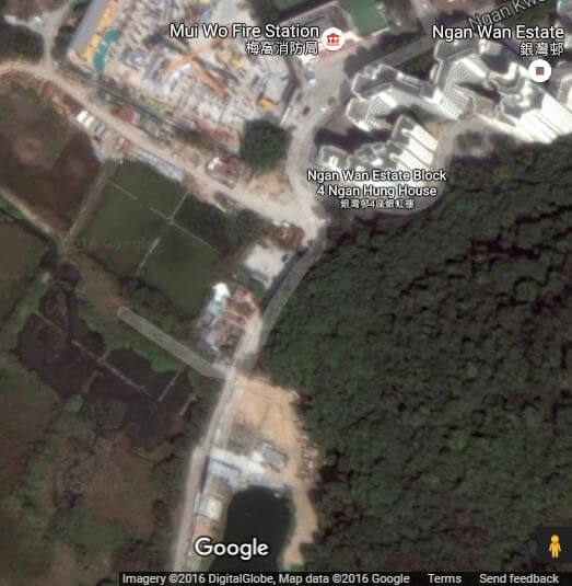
In one Thomas says, I wonder if those are what’s left of the salt pans. Pay attention to the rectangular swampy grids just below the construction site in the middle. They look very much alike the salt pans in Tai O.
Here’s a rather blurry detail of the Google image Thomas is referring to –

And here’s a CentaMap showing the same area –

Courtesy: Centamap
Thomas’ swampy grids are about a kilometre from the present coastline though reclamation would have been responsible for at least part of this and possibly the River Silver which passes close to them would have provided the necessary saline water.
The hunt for Eric’s RAF photos is still on…
See:
Related Indhhk articles:
